Before you start
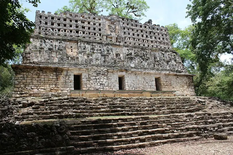
Yaxchilán lies deep in the rainforest of eastern Chiapas, on a great loop of the Usumacinta River, which here forms the border between Mexico and Guatemala. It is not a UNESCO World Heritage Site, but it is protected and managed by INAH, Mexico’s National Institute of Anthropology and History, and the only practical way in is by boat. This guide begins with the river journey from Frontera Corozal, then follows the path from the landing through the dark passages of the Labyrinth onto the Great Plaza, up to the temple of Lady K’abal Xook and Bird Jaguar’s great Structure 33, and finally to the South Acropolis on the highest hill.
Use it as a self-guided tour of Yaxchilán: 6 stops in visit order, each played when you’re ready, at your own pace.
 Free preview · Stop 1
The river journey
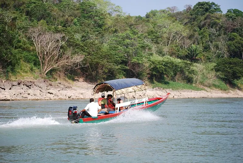
Your visit begins on the water. From the riverside village of Frontera Corozal, motor launches carry visitors downstream along the Usumacinta, one of the great rivers of Central America, for roughly forty minutes to an hour. Mexico is on one bank and Guatemala on the other, with forest rising on both sides. Watch for herons, kingfishers and, if you are lucky, crocodiles basking on the sandbanks. In ancient times this river was a highway, carrying canoes laden with goods, warriors and messengers between the kingdoms along its banks. Yaxchilán sits on a horseshoe bend, protected by water on three sides, which helps explain its strategic power. As the boat pulls in at the landing, listen: the deep roar from the trees is usually the call of howler monkeys, which you will probably hear throughout your visit.
Photo: Thelmadatter · CC BY-SA 3.0 · Wikimedia Commons
What to see at Yaxchilán: 6 stops, in visit order
- 01
 The river journeyRío UsumacintaFree preview
- 02
 The LabyrinthEl LaberintoIn the guide
- 03
 The Great PlazaGran PlazaIn the guide
- 04
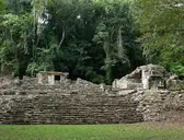 Structure 23Edificio 23In the guide
- 05
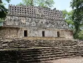 Structure 33Edificio 33In the guide
- 06
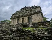 South AcropolisAcrópolis SurIn the guide
Site map of Yaxchilán
History of Yaxchilán
Yaxchilán was built by the Maya, whose civilisation took shape over more than three thousand years: the first farming villages appeared around 2000 BCE, great cities rose in the Preclassic period (to about 250 CE), the lowland kingdoms reached their height in the Classic period (about 250–900 CE), and northern Yucatán flourished on into the Postclassic, until the Spanish conquest, which began in the 1520s and ended only in 1697 with the fall of the last independent Maya kingdom, Nojpetén, in Guatemala. Maya people did not vanish: millions still live in Mexico and Central America, and the Ch’ol and Lacandon Maya live in this part of Chiapas today. Yaxchilán, whose ancient kingdom was called Pa’ Chan, ‘split sky’, was founded by the fourth century CE and grew into a powerful rival of Piedras Negras, just downstream.
The full history continues in the guide.
Yaxchilán guide: questions
How many stops does the Yaxchilán guide have?
6 stops, in visit order: 1. The river journey; 2. The Labyrinth; 3. The Great Plaza; 4. Structure 23; 5. Structure 33; 6. South Acropolis.
Can I do a self-guided tour of Yaxchilán with this guide?
Yes. The guide is made for a self-guided tour: 6 stops in visit order, each with a photo, a story and a voice, so you can explore Yaxchilán at your own pace, without joining a group. Download it before you go and it works offline.
How long is each guide?
The 6 stops add up to about 6 minutes of listening in total. You play each stop when you’re ready, so you can go at your own pace.
Does the guide work offline?
Yes, once it’s downloaded. The guide is a single self-contained web page (about 7.5 MB) with the photos, text and audio built in. Download it to your phone before you go (Wi-Fi is best); after that it opens in any modern browser on iPhone or Android, with no app, account or mobile signal needed.
Does it use GPS or need my location?
No. The guide doesn’t use GPS and doesn’t know where you are: you play each stop when you reach it. It works on iPhone and Android in any modern browser, and it’s in English.
What’s included?
One self-contained HTML guide: 6 stops in visit order, each with a photo, text and a voice, plus the story of who built the site.
Who built Yaxchilán?
Yaxchilán was built by the Maya, whose civilisation took shape over more than three thousand years: the first farming villages appeared around 2000 BCE, great cities rose in the Preclassic period (to about 250 CE), the lowland kingdoms reached their height in the Classic period (about 250–900 CE), and northern Yucatán flourished on into the Postclassic, until the Spanish conquest, which began in the 1520s and ended only in 1697 with the fall of the last independent Maya kingdom, Nojpetén, in Guatemala. Maya people did not vanish: millions still live in Mexico and Central America, and the Ch’ol and Lacandon Maya live in this part of Chiapas today.
Where is Yaxchilán?
Yaxchilán lies deep in the rainforest of eastern Chiapas, on a great loop of the Usumacinta River, which here forms the border between Mexico and Guatemala.
Is there a free audio guide to Yaxchilán?
The first stop, The river journey, is free to read and hear on this page, so you can try the Yaxchilán audio tour before you buy. The full guide, with all 6 stops, is a one-off purchase: download it once and it’s yours to keep, working offline.
Is the Yaxchilán guide worth it?
If you’d like to know what you’re looking at, yes. For $10 you get 6 stops in visit order, each with a photo, a short history and a voice you play when you’re ready, plus a site map of the stops, and about 6 minutes of listening in all. It’s short on purpose, so you spend your time looking, not listening. It’s yours to keep, works offline and needs no app. The first stop is free on this page, so you can try it before you buy. If you’d like hours of detail, a guided tour will go deeper.
Audio guide or guided tour?
It depends how you like to visit. This guide lets you explore Yaxchilán at your own pace, at any time, for a one-off price. A guided tour gives you a live expert you can ask questions, but at fixed times and usually for a higher price. Many people use both: a tour for the big picture, and the guide to read beforehand or to revisit the stops in their own time.
Is this the official Yaxchilán guide?
No. It’s an independent guide by The Historian Guide, not affiliated with or endorsed by the operator of Yaxchilán. For tickets and opening hours, check the official site operator before you go.
Does the guide include entry tickets or opening hours?
No. The guide is a digital companion only. Admission to Yaxchilán is separate, so check the official site operator for current tickets and opening hours before you go.
- Stop 1 · The river journey: Thelmadatter · CC BY-SA 3.0 · Wikimedia Commons · resized
- Stop 2 · The Labyrinth: Bernard DUPONT from FRANCE · CC BY-SA 2.0 · Wikimedia Commons · resized
- Stop 3 · The Great Plaza: Bernard DUPONT from FRANCE · CC BY-SA 2.0 · Wikimedia Commons · resized
- Stop 4 · Structure 23: Bernard DUPONT from FRANCE · CC BY-SA 2.0 · Wikimedia Commons · resized
- Stop 5 · Structure 33 (also the cover): Arian Zwegers from Brussels, Belgium · CC BY 2.0 · Wikimedia Commons · resized
- Stop 6 · South Acropolis: © ProtoplasmaKid / Wikimedia Commons · CC BY-SA 4.0 · Wikimedia Commons · resized


All photographs from Wikimedia Commons under the licences shown.
More guides in Mexico
 New Spain and Mexico8 stops · Colonial and modern Mexico
The Basilica of Guadalupe audio guide
Cross the great plaza of the world’s most visited Catholic shrine to see the image of Our Lady of Guadalupe, then climb the hill of Tepeyac.
 Maya6 stops · c. 600–800 CE
Bonampak audio guide
Three small rooms in the Lacandon forest painted with vivid Maya murals: a royal court, a battle and a celebration.
 Maya6 stops · c. 250–900 CE
Calakmul audio guide
Capital of the Snake Kingdom, rising out of the Campeche rainforest.
 New Spain and Mexico8 stops · Second Mexican Empire
Chapultepec Castle audio guide
Climb the hill of Chapultepec to the castle of a viceroy, an emperor and presidents, now the National Museum of History.
 Maya8 stops · c. 600–1200 CE
Chichén Itzá audio guide
El Castillo and its serpent of light, the greatest ballcourt in Mesoamerica and the Sacred Cenote.
 Mesoamerican6 stops · c. 300 BCE – 900 CE (pyramid)
Cholula audio guide
Tunnel into the Great Pyramid, then climb to the church on its summit and the view of the volcanoes.
Every guide, in every country
Yaxchilán and every other guide we publish, including future ones. One payment, no subscription.